Over the Pioneer Trail
Improvement Era, vol. 15, no. 10, August 1912, pp. 933 to 948
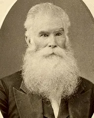
Over the Pioneer Trail THE ORIGINAL RECORD OF PROF. ORSON PRATT [On suggestion of Hon. B. H. Roberts, it was arranged by the General Board some weeks ago to provide for a company of M. I. *A. Scouts to pass over the old pioneer trail from Echo to Salt Lake City, the trip to be made in July, so that the boys might enter the Valley on July 24, Pioneer Day. The purpose of the trip, besides the outing, is to inspire the boys with the nobility of the work of the pioners, educate them in early Utah history, and encourage the building of an auto road over the old route. In harmony with this action, the Athletic Committee, under Chairman Lyman R. Martineau, arranged for a preliminary survey of the road by a number of the committee and others on June 25-28. A company composed of Dr. John H. Taylor, field man M. I. A. Scouts; B. -S. Hinckley, Secretary of the Deseret Gymnasium; J. D. Bowers, scout director of the Thirty-first ward; Edward H. Anderson, of the Era, and David B. Anderson, a student of Johns Hopkins Medical School, who took the photographs, proceeded toward Echo from Salt Lake City on June 25, on foot and team. They discovered that the route was open, and could be traveled by teams, except in short distances, with only little trouble. Considerable of the distance was traversed on foot. On the 27th, this company was met at Echo by B. H. Roberts, of the General Superintendency, and Lyman R. Martineau, Chairman of the Athletic Committee, who proceeded west from Echo over the trail. Both the companies had copies of the field notes of Orson Pratt, of the advance company of pioneers, and also those of President Wilford Woodruff, and John Brown, and the official diary of President Brigham Young. The field notes in the journal of Prof. Orson Pratt are so well taken that the company found no difficulty in following the exact trail of the pioneers through the various canyons. B. H. Roberts, before making the trip, wrote a description of the route for the Church history in the Americana, and found the notes so full and accurate that it was not necessary to change a line or word, after he had passed over the ground. The feasibility of taking a company of boy scouts over the railway to Echo, and returning them on foot over the old route to Salt Lake City, is unquestioned, and will be undertaken. Parts of the distances over the mountains are very interesting, and it is believed much historical good may come from a trip of that kind. It would give opportunity to impress the boys with the difficult labors, the
934 IMPROVEMENT ERA. determined purpose and noble design, as well as the wisdom, faith and hardships of the pioneers, experienced on their way over those beautiful hills and mountains, to their new home in the Valley. As the Scout company passed over the road, pictures were taken of a number of scenes which are produced herewith, in connection with the original notes of the great pioneer, Orson Pratt, from July 11 to 24, 1847.— Editors.] TRANSCRIPTS FROM THE JOURNAL OF ELDER ORSON PRATT, In Command of the Advance Company of Utah Pioneers, Complete from July n to 24, 1847. July 11, Sunday. — Mr. Craig and three others proceeded on their journey for the States. Mr. Goodyear and two Indians went down Bear River. The morning is clear, calm and pleasant, although it was cold during the night, forming considerable ice. About one and a half miles south we discovered a mineral tar spring, and a few rods to the northeast some sulphur springs. At this point the roads fork, a few wagon tracks bearing off to the south, while a few others bore down the small creek on which we were encamped. July 12. — This morning we resumed our journey, taking the right hand fork of the road down the creek, which is represented as being the nearest, and 13.4 miles brought us to Bear River ford. The river here is about 60 feet wide, 2l/2 feet deep ; a very rapid current and the bottom completely covered with rounded boulders, some of which were about as large as a human head. The height above the sea is 6,636 feet. Some speckled trout were caught in the stream this morning. The road again forks at this place. We took the right hand, which bore a few degrees south of west. For about two miles our road gradually ascended, and crossing a ridge we commenced descending, following down for several miles a ravine in which there was little water. Plenty of grass, of an excellent quality, is found in almost every direction. The country is very broken, with high hills and valleys, with no timber excepting scrubby cedar upon their sides. Antelope again appear in great abundance, but rather wild. Some ten or twelve were brought in by our hunters in the course of the day. The road is exceedingly difficult to find, excepting in places where the grass has not completely obscured it. We halted for noon a
OVER THE PIONEER TRAIL. 935 little east of a pudding-stone formation. This ledge is on the right of the road, which passes along its base. The rocks are from 100 to 200 feet in height, and rise up in a perpendicular and shelving form, being broken or worked out into many curious forms by the rains. Some quite large boulders were cemented in this rock. Mr. B. Young, being sick, concluded to stop a few hours and rest; several wagons stopped with him for company, the rest being requested to move on. We continued down the ravine but a short distance, where it empties its waters into a small tributary of Bear River, which we crossed and again began to ascend for some distance, when we crossed the ridge and descended rather abruptly at first but afterwards more gradually into another ravine, at the head of which was a good spring of cold water. We continued descending this ravine until towards evening when we camped at the foot of a ledge of rock on the right. Here is the mouth of a curious cave in the center of a coarse sandstone frontfng to the south, and a little inclined from the perpendicular. The opening resembles very much the doors attached to an outdoor cellar, being about 8 feet high and 12 or 14 feet wide. We called it Redden's Cave, a man by that name being one of the first in our company who visited it. We went into this cave about 30 feet, where, the entrance becoming quite small, we did not feel disposed to penetrate it any further. On the under side of the roof were several swallows' nests. Mr. Young did not overtake us tonight. July 13. — Early this morning we dispatched two messengers back to meet Mr. Young, being unwilling to move any farther until he should come up. The barometer here indicates quite a fall since leaving Bear River, the mercury standing, at half -past six a. m., 24.005, attached thermometer 62 deg., detached thermometer 60.5 deg. The morning is calm and clear. The two messengers returned, and Mr. H. C. Kimball with them. They reported Mr. Young as getting better, but that he did not think of moving yet today. Those of the Twelve present directed me to take 23 wagons and 42 men, and proceed on the journey, and endeavor to find Mr. Reid's route across the mountains, for we had been informed that it would be impracticable to pass through the canyon (i.e. Weber) on account of the depth and rapidity of
936 IMPROVEMENT ERA. the water. About 3 p.m. we started, and proceeded down Red Fork about eight and three-fourths miles and encamped. At present there is not much water in this fork thus far. The height of our encampment above the sea is 6,070 feet. July 14. — We resumed our journey; traveled about six and three-fourths miles, and halted for noon, latitude 41 deg. 1 min., 47 sec. In the afternoon traveled about six and one-fourth miles further, which brought us to the junction of Red and Weber SCENE IN ECHO CANYON At the junction of Echo creek, or Red Fork, and the winding Weber river. The wagon road from Coalville, the Union Pacific railway, and the branch line to Coalville, are shown. At the point of the Bluffs is located the old land mark, Pulpit Rock, as now modified and strengthened by masonry. The advance pioneers camped at this point on July 14, and from here Orson Pratt and his advance company proceeded down the river to find Reid's trail, or to learn if the Weber canyon was passable. Elevation 5,301 feet. forks. Our journey down Red Fork has been truly interesting and exceedingly picturesque. We have been shut up in a narrow valley from 10 to 20 rods wide, which upon each side the hills rise very abruptly from 800 to 1,200 feet, and the most of the distance we have been walled in by vertical and overhanging precipices of red pudding-stone, and also red standstone, dipping to the northwest in an angle of about 20 deg. (the valley of the Red Fork being about southwest). These rocks were worked
OVER THE PIONEER TRAIL. 937 into many curious shapes, probably by the rains. The country here is very mountainous in every direction. Red Fork, towards the mouth, is a small stream about eight feet across; it puts into Weber's fork from the right bank. Weber's fork is consisting of boulders; water very clear; its course bearing west-northwest. Height of the junction above sea, 5,301 feet. The road has been quite rough, crossing and re-crossing the stream a great number of times. There is some willow and aspen in the valley and upon the side hills, and some scrubby cedar upon the hills and rocks as usual. July 15. — We resumed our journey down Weber's fork, crossing onto the left bank. Traveled about six miles, and enUNION PACIFIC RAILWAY STATION AT ECHO camped about one mile above the canyon, which at the entrance is impassable for wagons. The road, crossing the river to the right bank, makes a circuit of about two miles, and enters the canyon at the junction of a stream putting in from the right bank, about one-third as large as Weber's fork. I rode on horseback, in company with Mr. Brown, about five miles down from our encampment, and being convinced that this was the ten-mile canyon which had been spoken of, we returned to camp. In the meantime Mr. Markham, with one or two others, had gone
938 IMPROVEMENT ERA. up the river on the right bank, in search of Reid's trail across the mountains, leading down to the southeastern shores of the Salt Lake. Mr. Brown and I also went in search, traveling along the bluffs on the south. We soon struck the trail, although so WITCH ROCKS Curious formations rising 50 to 80 feet in the air. These are located about two miles from Echo, about half way between Echo and Henefer, on the hills on the right bank of the river at the place where the Pioneers passed prior to crossing the river just above Henefer. dimly seen that it only now and then could be discerned ; only a few wagons having passed here one year ago, and the grass having grown up, leaving scarcely a trace. I followed this trail about six miles up a ravine, to where it attained the dividing ridge leading down into another ravine, in a southerly direction, and returned again into camp. There is some cottonwood timber fringing the shores of Weber's fork, and also thick clusters of willows, making very close thickets for bears, which, from their large tracks and the large holes they had made in digging for roots, must be very numerous. July 16. — At half-past four o'clock this morning we were visited by a thunder shower ; nearly rain sufficient to lay the dust, which is rather more than usually falls in the showers which have been frequent for a few days past. At half-past five o'clock the
OVER THE PIONEER TRAIL. 939 barometer stood at 24.779, attached thermometer 53 deg., detached thermometer 52 deg. Calm, and still partially cloudy. We concluded to send Mr. Rockwell back, to report to the portion of the pioneers that we had found the new route, &c, which we had anticipated would be troublesome to find. We resumed our journey up a small stream on Reid's route, sending in advance ON THE IIENEFER BENCH Left side of the river, showing the canyon to the left up which the pioneers passed. On the roadside the primitive sage still flourishes. of the wagons a small company of about a dozen with spades, axes, &c, to make the road passable, which required considerable labor. We traveled about six miles, and, crossing the ridge, began to descend another ravine. Traveled about two and a half miles, which took about four hours' labor, and encamped for the night. Plenty of grass and water ; some antelope ; small willows in abundance. After we had encamped Mr. Newman and myself walked down the ravine to examine the road. We found that Mr. Reid's company last season had spent several hours' labor in spading, &c, but finding it almost impracticable for wagons they had turned up a ravine, at the mouth of which we hac1 encamped and taken a little more circuitous route over the hills. July 17.— A severe frost during the night. Early this morn-
940 IMPROVEMENT ERA. ing I started out alone, and on foot, to examine the country back, to see if there was not a more practicable route for the companies in the rear than the one we had come. I was soon satisfied that we had taken the best and only practicable route. Met a large grey wolf about four rods from me. I returned to camp and counseled the company not to go any further until they had spent several hours' labor on the road over which we passed yesterday afternoon ; and all who were able to work labored about two-thirds of the day upon the same ; and, leaving orders for the camp towards night to move on, Mr. Brown and myself rode on to explore. About three and one-eighth miles brought us down the right bank of the creek, which was about twenty feet wide ; swift current. This creek passes through a canyon about 40 rods below, where it is for a few rods shut up by perpendicular and overhanging walls, being a break in the mountain, which rises several hundred feet upon each side. The creek plunges underneath a large rock which lies in its bed, near the foot of the canyon, blockading trie same, and making it impassable for wagons or teams. We followed the dimly traced wagon tracks up this stream for eight miles, crossing the same thirteen times. The bottoms of this creek are. thickly covered with willows, from 5 to 15 rods wide, THE EAST CANYON RESERVOIR Of the Davis and Weber Counties Canal Company, looking down the river to the dam. Orson Pratt and his advance company camped some forty rods above the narrows where the dam is now located, about nine miles from Henefer.
OVER THE PIONEER TRAIL. 941 making an immense labor in cutting a road through for the emigrants last season. We still found the road almost impassable and requiring much labor. The mountains upon each side rise abruptly from 600 to 3,000 feet above the bed of the stream. Leaving our horses at the foot, we ascended to the summit AT CLAYTON S RANCH Here some of the Scout company had fine fishing, the results of which all enjoyed. About four miles from East Canyon dam. Dutch Canyon just back of the barn. of one which appeared to be about 2,000 feet high. We had a prospect limited in most directions by still higher peaks ; the country exhibited a broken succession of hills piled on hills, and mountains on mountains, in every direction. We returned and met our camp about four and three-fourth miles from where they were encamped in the morning. They were encamped about two miles above the canyon, on the left bank of the Canyon creek. At this place there is a small rivulet which runs down from the mountains : the water pure and cold. July 18, Sunday. — The morning is cold, and the ground whitened by frost. We remained in our encampment today. Attended meeting in the forenoon. Latitude 40 deg., 54 min., 7 sec. A lunar observation was taken for the longitude. I also obtained an observation of the altitude of the moon for time. July 19. — The morning cold and frosty, but in the middle
942 IMPROVEMENT ERA. of the day it is exceedingly warm. Mr. Brown and myself started soon after sunrise to examine the road and country ahead. We ascertained that the road left Canyon creek near the place where we stopped the day before, and ran along in a ravine to the west. We ascended this ravine gradually for four miles, when we came to the dividing ridge. Here we fastened our horses, and ascended GOING UP DUTCH CANYON From Clayton's ranch toward the summit of Big Mountain, distance about six miles, it was necessary in some places to tie ropes to the wagon to hold it from plunging into the ravine and creek below. Beautiful aspen groves, pines, wild-flowers, and wild cherries in bloom, abounded on all sides. The pioneers went up East Canyon about five miles from Clayton's, then turned west up what was later known as Little Emigration Canyon, four miles to summit of Big Mountain. on foot a mountain on the right for several hundred feet. Both from the ridge where the road crosses, and from the mountain peak, we could see over a great extent of the country. On the southwest we could see an extensive level prairie, some few miles distant, which we thought must be near the lake. We came down from the mountain and mounted our horses, and rode down on the southwest side of the mountain, the descent is very rapid at first. We traveled down several miles and found that the small stream we were descending passed through a very high mountain, where we judged it impossible for wagons to pass, and after
OVER THE PIONEER TRAIL. 943 searching awhile, we found that the wagon trail ascended quite abruptly for about one and one-half miles, and passed over a mountain, and down into another narrow valley, and thus avoided the canyon ; and after making these explorations we returned to our camp, which we met six and one-fourth miles from their SCENE ON THE WAY UP EAST SIDE OF BIG MOUNTAIN morning encampment, having performed a great deal of labor on the road. Mr. Rockwell had returned, bringing us the intelligence that the most of the pioneer wagons were within a few miles of us. A fresh track of a buffalo was discovered in this ravine. He had rubbed off some of his hair upon the brush in his path, probably the only one within hundreds of miles. July 20. — The morning is frosty. I wrote a description of the road and country which we had traversed for several miles ahead, and left the same deposited in a conspicuous place for the benefit of the camp which were soon expected to pass. We resumed our journey about 9 o'clock in the morning, being hindered more than usual by some cattle which had strayed a short distance. We traveled today about six miles over the mountains, laboring diligently upon the road. The barometrical observations on the dividing ridge were 23.137, attached thermometer 80 deg., detached thermometer 76 deg., giving for the height of the same above the sea 7,245 feet.
944 IMPROVEMENT ERA. July 21. — No frost this morning, but a heavy dew. We resumed our journey, traveled two and one-half miles, and ascended a mountain for one and one-half miles ; descended upon the west side one mile ; came upon a swift running creek, where we halted THE SCOUT COMPANY Going east, on the summit of Big Mountain. Left to right: B. S. Hinckley, on horseback, Dr. John H. Taylor, Edward H. Anderson, John D. Bowers, and Booze, Bowers' busy dog. Elevation 7,245 feet. for noon. We called this Last Creek. Brother Erastus Snow (having overtaken our camp from the other camp, which he said was but a few miles in the rear) and myself proceeded in advance of the camp down Last Creek four and one-half miles, to where it passes through a canyon and issues into the broad, open valley below. To avoid the canyon the wagons last season had passed over an exceedingly steep, dangerous hill. Mr. Snow and myself ascended this hill, from the top of which a broad, open valley about 20 miles wide and 30 long, lay stretched out before us at the north end of which the broad waters of the Great Salt Lake glistened in the sunbeams, containing high mountainous islands from 25 to 30 miles in extent. After issuing from the mountains among which we had been shut up for many days, and beholding in a moment such an extensive scenery open before us, we could not refrain from a shout of joy which almost involuntarily escaped from our lips the moment this grand and lovely scenery was
OVER THE PIONEER TRAIL. 945 within our view. We immediately descended very gradually into the lower parts of the valley, and although we had but one horse between us, yet we traveled a circuit of about twelve miles before we left the valley to return to our camp, which we found encamped one and one-half miles up the ravine from the valley, ■M,£- k, yy 4m ■Ryi\ v, \ d» * %v^P\ iSSft^^trvij. ^fi s^^B^^H Rf&l Ih ifP' '^^^^WBBWH^ ■'' '•'■••',. ' * • '-.-' 1 THE SCOUT COMPANY GOING WEST Get a first glimpse of the valley; left to right: Dr. John Taylor, L. R. Martineau, John D. Bowers, B. H. Roberts, on horseback with fieldglass in hand, delighted with the view. and three miles in advance of their noon halt. It was about nine o'clock in the evening when we got into camp. The main body of the pioneers who were in the rear were encamped only one and one-half miles up the creek from us, with the exception of some wagons containing some who were sick, who were still behind. July 22.— This morning George A. Smith and myself, accompanied by seven others, rode into the valley to explore, leaving the camp to follow on and work the road, which here required considerable labor, for we found that the canyon at the entrance of the valley, by cutting out the thick timber and underbrush, connected with some spading and digging, could be made far more preferable than the route over the steep hill mentioned above. We accordingly left a written note to that effect, and passed on. After going down into the valley about five miles, we turned our course to the north, down towards the Salt Lake. For three or four
946 IMPROVEMENT ERA. miles from the mountains the springs were very abundant, the water excellent, and generally with gravel bottoms. A great variety of green grass, and very luxuriant, covered the bottoms for miles where the soil was sufficiently damp, but in other places, LOOKING EAST FROM THE SUMMIT OF BIG MOUNTAIN, LITTLE EMIGRATION CANYON LEADING TO THE RIGHT Up this the Pioneers came after leaving East Canyon some four and three-fourth miles up the stream from Clayton's. The road in Little Emigration Canyon for a distance of four miles is not passable by teams but there is a good trail. although the soil was good, yet the grass had nearly dried up for want of moisture. We found the drier places swarming with very large crickets, about the size of a man's thumb. This valley is surrounded with mountains, except on the north ; the tops of some of the highest being covered with snow. Every one or two miles streams were emptying into it from the mountains on the east, many of which were sufficiently large to carry mills and other machinery. As we proceeded towards the Salt Lake the soil began to assume a more sterile appearance, being probably at some seasons of the year overflowed with water. We found as we proceeded on, great numbers of hot springs issuing from near the bases of the mountains. These springs were highly impregnated with salt and sulphur ; the temperature of some was nearly raised to the boiling point. We traveled for about fifteen miles down after coming into the valley, the latter part of the distance
OVER THE PIONEER TRAIL. 947 the soil being unfit for agricultural purposes. We returned and found our wagons encamped in the valley, about five and a quarter miles from where they left the canyon. July 23. — This morning we despatched two persons to President Young, and the wagons which were still behind, informing them of our discoveries and explorations. The camp removed its position two miles to the north, where we encamped near the bank of a beautiful creek of pure cold water. This stream is sufficiently large for mill sites and other machinery. Here we called the camp together, and it fell to my lot to offer up prayer and thanksgiving in behalf of our company, all of whom had been preserved from the Missouri River to this point : and, , ,. . LITTLE MOUNTAIN after dedicating ourselves and the land unto Looking up the west slope, leading up the Lord, and imploring from Emigration Canyon, his blessings upon our labors, we appointed various committees to attend to different branches of business, preparatory to putting in crops, and in about two hours after our arrival we began to plough, and the same afternoon built a dam to irrigate the soil, which at the spot where we were ploughing was exceedingly dry. Towards evening we were visited by a thunder shower from the west, not quite enough rain to lay the dus*. Our two messengers returned, bringing us word that the re-
948 IMPROVEMENT ERA. mainder of the wagons belonging to the pioneer company were only a few miles distant, and would arrive the next day. At 3 p.m. the thermometer stood at 96 degrees. July 24.— This forenoon commenced planting our potatoes; after which we turned the water upon them and g ive the ground quite a roaking. In the afternoon the other camp arrived, and we found all camp at the foot of big mountain the sick improving very Beautiful Mountain Dell Canyon. Dinner fast, and were so as to over; reading the field notes. , , , be able to walk around. Towards evening another thunder shower from the southwest, but not enough rain to benefit the ground. THE PHOTOGRAPHER